Ophelia hurricane: A Hurricane’s Journey
Ophelia, a formidable tropical storm, made its presence known when it made landfall near Emerald Isle, North Carolina, during the early hours of Saturday morning. It is currently on a trajectory that will take it further inland, impacting regions along the East Coast. As it progresses, it is expected to bring with it substantial rainfall, powerful winds, and coastal flooding, extending well beyond its central location.
Upon its arrival, Ophelia unleashed sustained winds reaching 70 mph, just a hair’s breadth below hurricane status. Tropical-storm force winds have a reach of up to 310 miles from the storm’s core. These intense winds resulted in power outages affecting no less than 70,000 homes and businesses across the mid-Atlantic and North Carolina, according to data compiled by the utility tracking website, PowerOutage.us, as of early Saturday.
Though the storm had winds clocking in at 65 mph as of 8 a.m., it is anticipated to weaken gradually as it ventures deeper inland. Nevertheless, power outages could intensify as it impacts more areas.
The National Hurricane Center has mapped Ophelia’s course, which involves traversing eastern North Carolina before continuing on to southeastern Virginia. Subsequently, it is projected to move further north across the Delmarva Peninsula on both Saturday and Sunday. Significantly, the storm’s expansive rain shield stretches over hundreds of miles from its epicenter, already drenching substantial portions of the mid-Atlantic region. States including Virginia, Maryland, Delaware, New Jersey, and New York are already witnessing heavy rainfall.
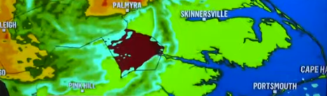
The most severe repercussions of the storm are being felt along the coastal regions of North Carolina as the storm’s center advances into the state. Storm surges have inundated coastal areas and inlets in North Carolina during the night, and winds gusting as high as 73 mph have struck Cape Lookout along the state’s Outer Banks.
The onset of flooding began on Friday, submerging roads in communities situated along North Carolina’s coastline. Even though Highway 12 on coastal Cedar Island remained open and passable, it became inundated with water, according to the state transportation department. In a social media post, the department issued a cautionary advisory, urging people to refrain from venturing out unless absolutely necessary due to sandy and waterlogged roadways, compounded by the dark and turbulent conditions.
In the city of New Bern, located approximately 120 miles east of Raleigh and nestled amidst two rivers, roads were submerged, and water encroached further inland as water levels surged within the downtown area. City officials shared updates on Facebook, including images depicting a children’s park submerged in floodwaters and ducks navigating streets awash with water.